Building date:
Original use:
Corner structures:
Mortar application and content:
Types and uses of stones:
Types and choice of windows:
Structures with similar masonry details:
Masons who worked on building:
Unique features:
Map views courtesy Google Maps View 1 South end of Church Street looking north. 2D view of Church Street looking west. Address is Google Earth confirmed; 50°49'54.28"N 0°16'31.39"W.
Location of Manor House shown.
Per the book "Cobblestone Landmarks of New York State", Church Street numbers 9, 11, 18, 20, 22, and 24 are supposedly coursed beach flint construction; however, as of the Google Maps image capture date of June 2018, most of these structures are now stuccoed and few have visible street numbers.
Moving north up Church Street to view structures with cobblestone exteriors still visible.
Google Maps View 3 on left, #20 Church St. 1754
Google Maps View 5 Manor House, 50°49'57.49"N 0°16'30.45"W
Sussex, England Maps.
- "Cobblestone Landmarks of New York State", 1978, by Olaf William Shelgren, Jr., Cary Lattin, and Robert W. Frasch, Photographs by Gerda Peterich: Name reference, Manor House
- Page 9
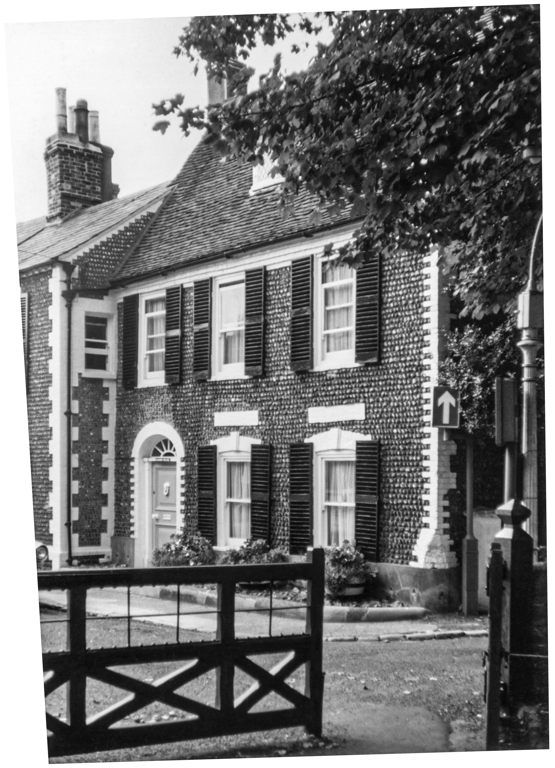 Sus-1 Manor House.jpg ¹ Manor House, date unknown. |  A number of Cobblestone structures listed on this page require photographs. |
¹ Photograph courtesy Robert Frasch, Cobblestone Museum.
